Ecological Surveys and reporting
ECOLOGICAL Services
Photo: Beth Hunt

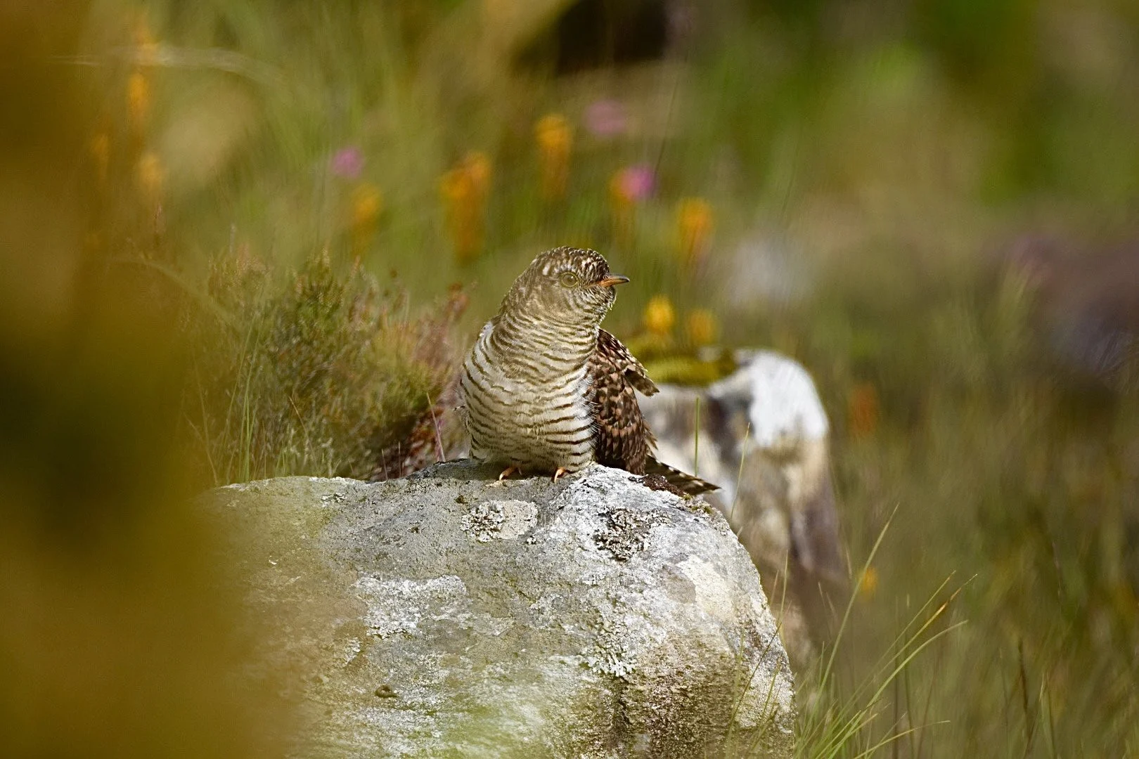
BIRDS
Bird surveys are often required to support planning applications in the Western Isles, where proposals may interact with sensitive bird species, including Schedule 1 species and qualifying features of Special Protection Areas (SPAs).
Across the Outer Hebrides, bird surveys are informed by our ornithologists’ local knowledge of species distribution, habitats and seasonal patterns. This understanding shapes survey design and timing, helping ensure that survey effort is proportionate, appropriate to the site, and compliant with current guidance. Practical considerations such as weather, access and remoteness are routinely factored into survey planning.
A range of bird surveys are undertaken in line with recognised guidance and best practice, including breeding bird surveys, wintering bird surveys and vantage point surveys, as well as more specialised surveys required in the Western Isles, such as corncrake and breeding diver surveys.
Specialist ornithological support can be provided for projects involving aviation or remote access requirements. This includes advising on bird sensitivity in relation to helicopter operations, infrastructure maintenance and drone operations.
survey capabilities:
Monitoring of Schedule 1 species
Pre-construction nest checks
Diver surveys
Corncrake surveys
Breeding bird surveys
Vantage point surveys
Wintering bird surveys
Photos: Barnaby Ashton
Protected species
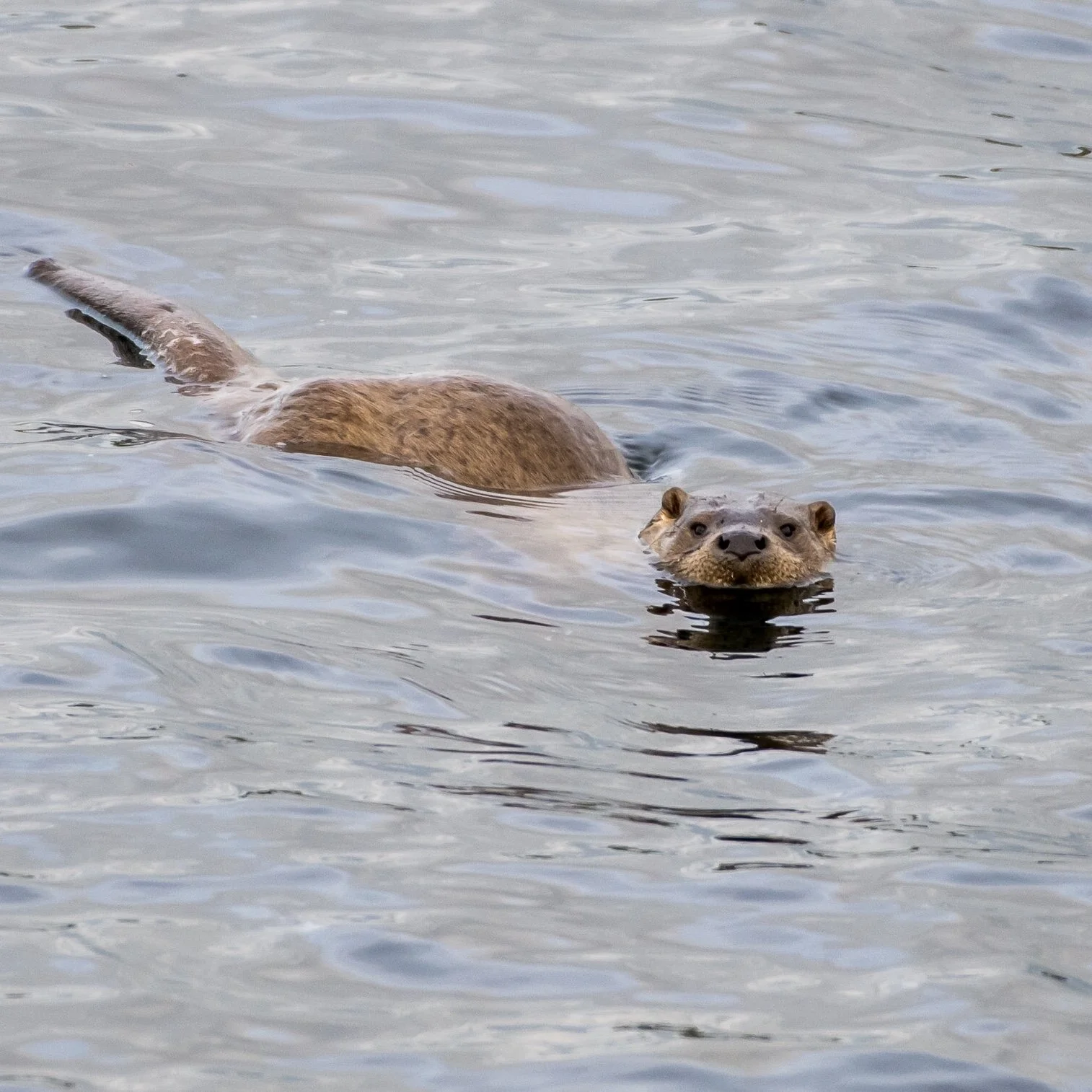
The Western Isles support a range of protected species that may need to be considered as part of development proposals. These include European Protected Species such as otter, bats and freshwater pearl mussel, as well as other protected species including mountain hare, Atlantic salmon and reptiles (slow worm).
Protected species surveys are informed by species distribution, habitat use and seasonal constraints, allowing survey requirements to be targeted and proportionate while remaining compliant with relevant legislation and guidance. Where protected species are identified as a potential constraint, clear advice is provided on survey scope, mitigation and licensing requirements.
OTTER
Bats occur at the edge of their range in the Western Isles and are protected as a European Protected Species. Bat surveys typically begin with a Preliminary Roost Assessment, with further survey work undertaken where roost potential is identified. Surveys are designed in line with recognised guidance and reflect local conditions and constraints. We can also support licensing and advise on appropriate mitigation where works may affect a roost.
BatS
Otter are widespread across freshwater and coastal habitats in the Western Isles and are afforded European Protected Species protection. Otter surveys assess habitat suitability, identify field signs and record any resting places that may be affected by proposed works. Where a potential resting place is identified close to development, further monitoring may be required to determine use. Where impacts cannot be avoided, we can support licence applications and advise on mitigation and construction-phase controls.
OTher protected species
Surveys may also be required for other protected species known to occur locally. These can include mountain hare, freshwater pearl mussel, reptiles (slow worm only) and Atlantic salmon. Survey requirements are often informed by our local expert knowledge, with advice provided early to ensure survey effort is appropriate and proportionate.
Photo: Barnaby Ashton
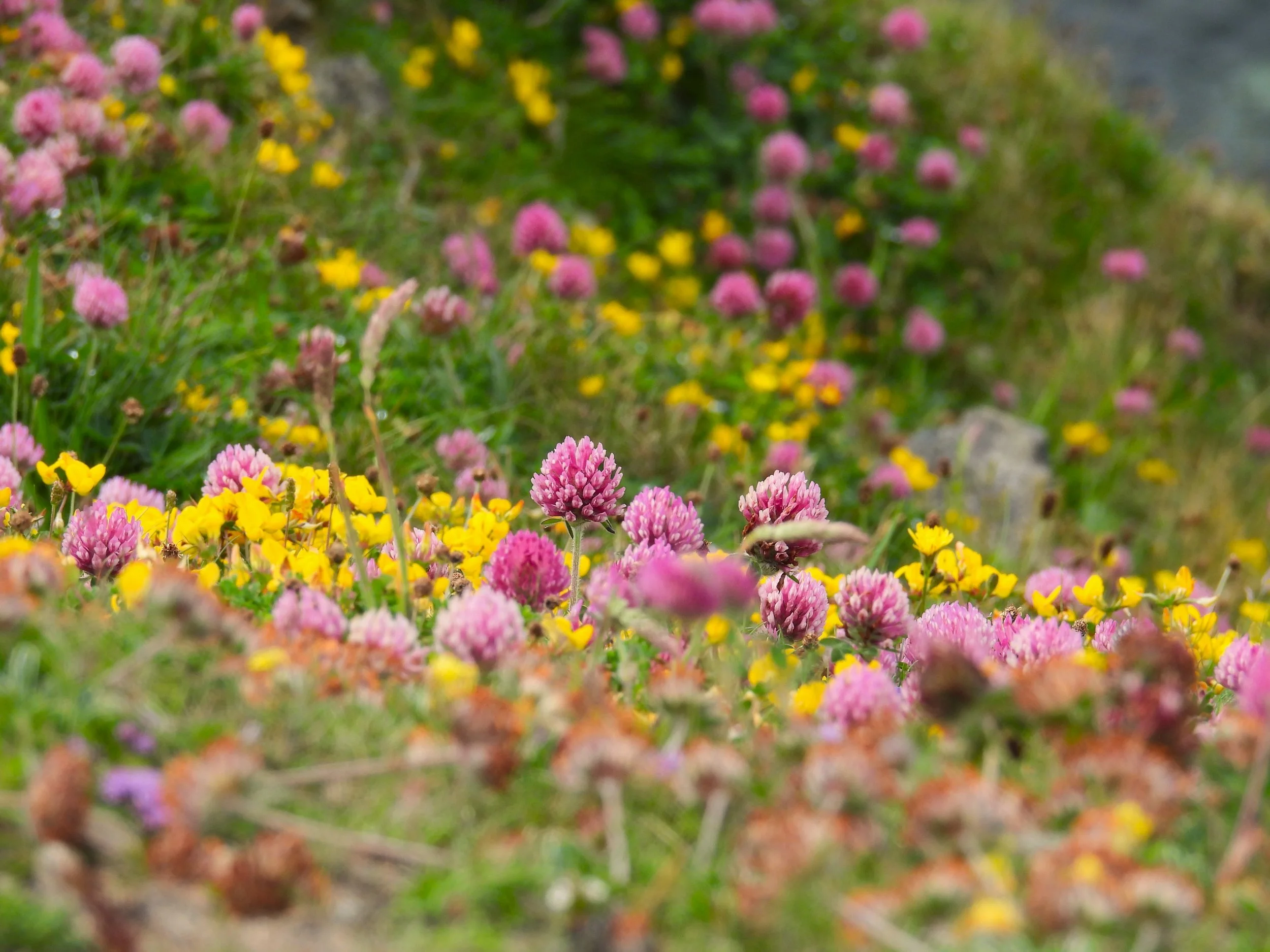
HABITAT and VEGETATION
Habitat and vegetation surveys provide baseline information on the habitats and plant communities present within a site and form a key component of ecological assessment and land management. In the Western Isles, surveys often relate to internationally important habitats associated with Special Areas of Conservation (SACs), including protected habitats such as machair and blanket bog.
Phase 1
Phase 1 habitat surveys provide an overview of habitat types and vegetation communities. They are widely used to inform Preliminary Ecological Appraisals (PEAs), Ecological Impact Assessments (EcIAs) and Environmental Impact Assessments (EIAs). Surveys are undertaken using standard Phase 1 methodology in line with JNCC guidance and are used to identify key ecological features, potential constraints and requirements for further survey work.
UKHAB
UKHab surveys provide a more detailed and standardised approach to habitat mapping and classification. This methodology aligns with current best practice and supports biodiversity assessment, monitoring and reporting. UKHab is the recognised standard for Biodiversity Net Gain calculations and is increasingly required to support planning and land management proposals.
invasive non-native species
Invasive Non-Native Species (INNS) surveys identify the presence of invasive plant species that can affect native biodiversity and habitat condition. Many invasive plants are listed under Schedule 9 of the Wildlife and Countryside Act 1981 (as amended), and it is an offence to plant, release or cause them to grow in the wild without lawful authority.
INNS are an important consideration in ecological assessment because they can influence baseline conditions, constrain development design and affect the success of habitat enhancement or restoration measures. Surveys provide baseline information to inform risk management and appropriate biosecurity and control measures during construction and ongoing land management.
Photo: Ruth Jeavons